|
|||||||||||||||||||||||||||||||||||||||||||||||||||||||||||||||||||||||||||||||||||||||||||||||||||||||||||||||||||||||||||||||||||||||||||||||||||||||||||||||||||||||||||||||||||||||||||||||||||||||||||||||||||||||||||||||||||||||||||||||||||||||||||||||||||||||||||||||||||||||||||||||||||||||||||||||||||||||||||||||||||||||||||||||||||||||||||||||||||||||||||||||||||||||||||||||||||||||||
 |
|
As you might imagine, with a city this size, there are many different aspects to consider when trying to describe the nature of the city. It would take up too much space to give a comprehensive description, so I will pick and choose aspects of life here without regard for anything other than my fancy. As such, I am sure it will be slanted in some direction or other, but then it probably should be.
 |
 |
 |
|||||
|
Skyline |
Skyline | Skyline | |||||
 |
 |
 |
|||||
|
Melbourne Cricket Grounds |
Inside Melbourne Cricket Grounds |
Flinders Station |
|||||
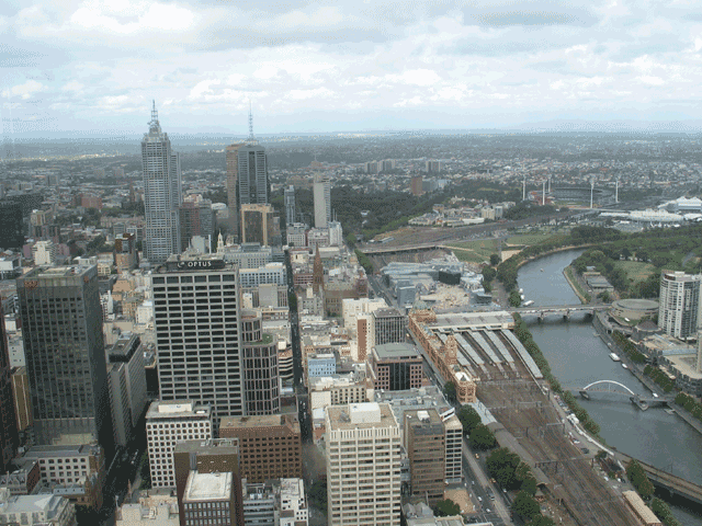
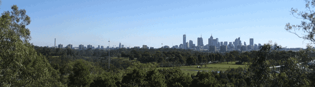
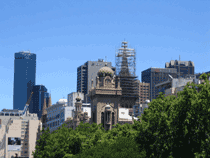
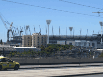
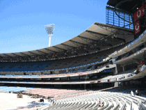
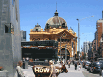
The CBD is where all of the major businesses reside. It is much like any big city with a central train station, city hall, head branch of the library, cathedrals, hotels, banks , shopping malls, museums, arts centers, numerous parks, large and small, sports stadiums and ethnic sections such as Chinatown. A tram system stretches over most of the metropolitan region lending a bit of charm to the downtown area. The high rise buildings tower over the center of the city and each has some unusual structure on its apex to enhance the feeling of a modern city.
Just south of the main segment of the CBD is the Yarra River. It is mostly used for tourist traffic these days and from an overhead view looks like a snake as it wends it way to Port Phillip Bay at Williamstown. Many bridges span the river and pedestrians can easily traverse from one bank to the other. The topology of the city is by no means flat. A walk out from the CBD to our little suburb involves a 45 minute jaunt, at times uphill. The city streets form a simple grid pattern. Automobile, tram, bus and foot traffic abound. Street corners are equipped with crossing lights which include a distinct audible alert, much like a mallet hitting a hollow block of wood, for the vision impaired. Every corner has a ramped curb to facilitate wheelchair access. And of course, every park, large or small, has at least one cricket oval. It is, after all, an Australian city.
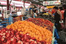
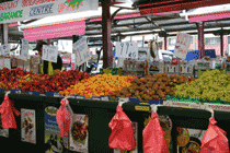
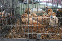
The Queen Victoria Market is an open air market directly on the edge of the CBD. It is open from 6 am almost every day and sells a variety of foods and goods. Meat, fish and produce mongers shout out to prospective buyers, assuring them of the lowest prices and (not always) freshest goods. Non-food items are also available - aisles and aisles of tee shirts, leather goods, sheepskin boots (UGGs), luggage, socks, jewelry, aboriginal artwork, textiles, homeopathic remedies, hardware store items and lots of Australian souvenirs (made in China, unfortunately) are to be had for cheap prices. The market is actually the best place for fresh produce, so we make a trip there on a regular basis to stock the pantry.
 |
 |
 |
|||||
| Fresh fruit for sale | Plenty of fresh fruit for sale | Some of it is fowl | |||||
There are a number of municipalities within the greater Melbourne region. The city where we live is called Yarra and encompasses a number of communities with names of their own. Our community, Carlton North, is part of Carlton which is north and slightly east of the CBD. Each of these communities supports the larger mission of the city and governmental services are provided by the city to each of these communities.
 |
 |
||||
| Drummond Street looking north |
Drummond Street looking south to the city |
||||
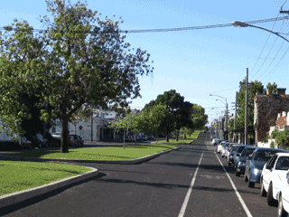
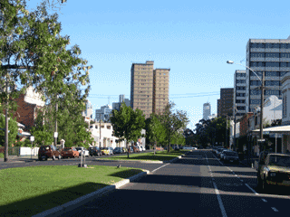
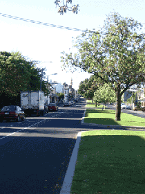
Drummond Street is a quiet residential street one street east of Lygon Street. Drummond enjoys a very large center isle separating the two directions of traffic flow and this median is often used by residents for picnics and holiday parties. The street is lined with terrace houses of Victorian architecture characteristic of this section of the city.
 |
 |
 |
||||||
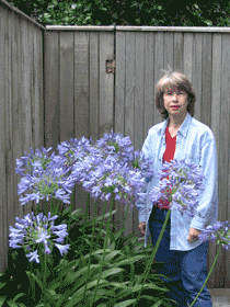
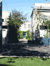
| Flowers out our front door | The mosque on Drummond St | Our driveway access to house | ||||||
 |
 |
 |
||||||
|
Our townhouse on left |
View from the right of the building |
View from the left of the building |
||||||
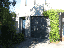
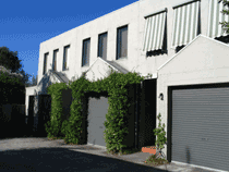
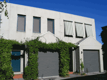
Our townhouse is set back from the street about 100 feet by a short driveway between two residential buildings located directly on the street. Our suite is one of three within the building and is comprised of two floors.
 |
||||
|
An expanded view of our first floor in Drummond Street |
||||
The downstairs is one large carpeted room with a kitchen area set off by a counter system. A garage is part of the layout making parking a non-issue. The upstairs consists of two equally carpeted bedrooms and a master bath between them. The front bedroom has its own bath with shower, while the main bathroom has tub and shower. At the back of the house is a set of full length glass doors that open into a small foliated courtyard which backs up to another house on another street. The place is completely furnished and nicely appointed. It came complete with television, telephone and library.
 |
 |
|||||
|
The desk area and hat storage |
The simple but effective ham radio station | |||||
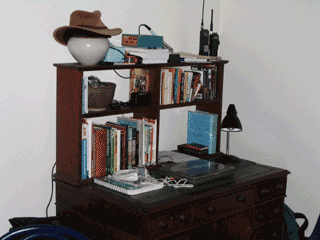
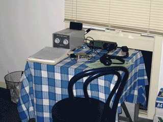
My meager ham radio setup is shown here along with the desk next to it with the library and work area. Of late, I have been using the dining room table to spread out on, but we still use the desk from time to time.
 |
 |
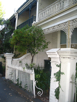
| Typical house on Drummond Street | Another typical house on Drummond Street |
 |
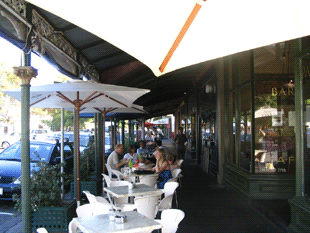 |
| Rathdowne Street Shops | Rathdowne Street Restaurants |
 |
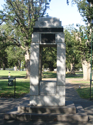 |
| Rathdowne street home | A monument and fountain on Rathdowne Street |
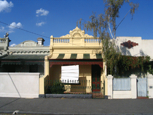
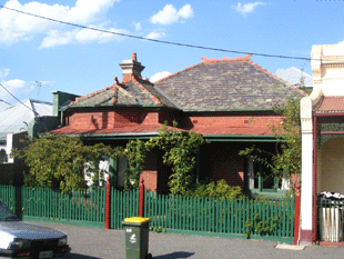
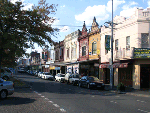
These should give you a sense of the architecture of the neighborhood.
 |
|
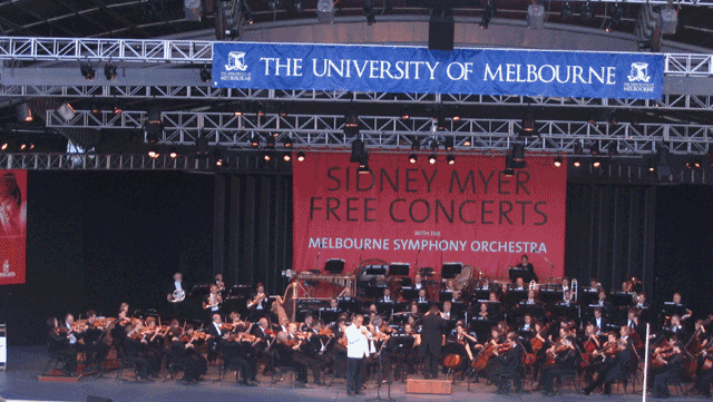
Just south of the CBD lies the garden area of the city. The Royal Botanical Gardens, with free access to numerous footpaths linking the various gardens, lawns and lakes, is a gem in the middle of the city. In the middle of one of the gardens is a large concert bowl hollowed into the hillside similar to the Hollywood Bowl, established in 1958 with money donated by businessman and philanthropist Sidney Myer. It hosts outdoor concerts and entertainment events. We had the distinct pleasure of attending several outdoor lawn concerts featuring the Melbourne Symphony Orchestra. These summer affairs are designed for the general public, are free and commence around 7:00 PM and run till 8:30 to 9:00 PM. The intent is to promote a picnic atmosphere and the only restriction is that glass is banned. Plastic cups, bottle glass and the like are allowed so it is not an alcohol free event. However, the clientele attracted to this event is not one to indulge in excessive behavior, so things were quite civilized.
The programs we attended featured vocal and instrumental soloists along with the orchestra, all playing and singing at a very top-notch level. The programs were lively and akin to those one might experience watching the Boston Pops Orchestra. On the night when temperatures soared well into the 80s, however, the musicians had removed their tuxedo jackets and played in shirt sleeves.
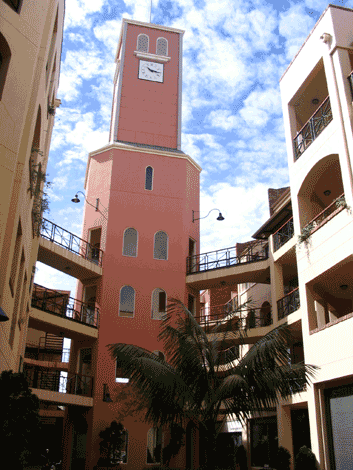
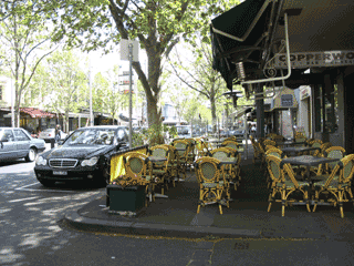
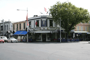
Lygon street was probably the first street we explored when we arrived here in Melbourne. The hotel, the Carlton Clocktower where we stayed until our residence was ready, backed onto Lygon right at the active restaurant section. It is famous in Melbourne for its Italian cuisine locales and nightlife. It stretches from the city center all the way up to near the airport which is quite a ways.
 |
 |
|
Nice locale on Lygon Street |
|
 |
|
|
The Carlton Clock Tower Hotel |
Corner hotel on Lygon Street |
Local business line the streets and night life is quite active.
One of the two singing groups that Edite joined is a small ad hoc group calling itself 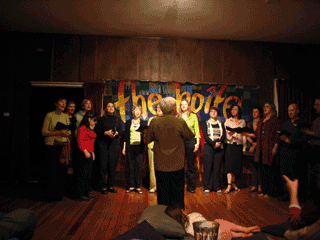 "Thursday's Children". They practice on Thursday nights (and hence the name) and are a group of folks that like to get together and sing. Their program is typically of a multicultural nature and they have been working for some time to collect money for a musical program for the children of East Timor. They have held several concerts in a small coffee house called the Boite, a french word meaning "the box". In addition, they do "busking", which means performing for collection of money at venues such as parks, outdoor markets, street corners. The songs they sing require a good deal of memorization as they are often in other languages and usually third world nation languages at that.
Since they have been raising funds for the Timor children, they are disposed to getting it to those children. To that end, they are sponsoring a trip to East Timor in June of this year to tour and sing for and with the Timorese and Edite has decided to accompany them. This should prove to be an exciting experience. The results will most likely be published among these pages, so stand by.
St. Kilda Beach
 |
||||
 |
||||
| Relax on the strand | Fi relaxing on the strand | |||
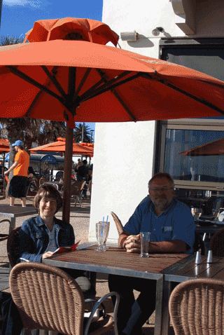
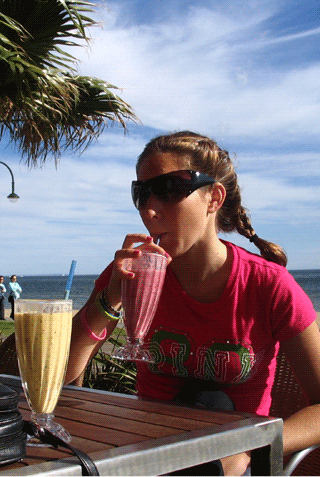
The closest beach to the CBD is called St. Kilda beach. It is one of many beaches making up the shores of Port Philip Bay, the entrance into Melbourne. These beaches closest to the city are not prime swimming areas, as the water is not as pristine as it is further away from the city. However, boardwalks line the shore and eateries, bars, clubs, craft fairs, yachting clubs and even an amusement park are to be found here. It is a busy place, night and day.
Emu Bottom
 |
 |
 |
||||
| A whip demonstration |
Pre-dinner cocktails |
Aboriginal instruments | ||||
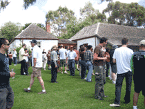
This is a homestead museum located north of Melbourne and was the site of the 2005 Melbourne Uni School of Chemistry Christmas celebration. The entire school, or those that signed up soon enough, boarded buses to the site and were entertained with bull whipping displays, boomerang tossing events, gum boot tossing competitions and a very nice sit-down meal, complete with song and show.
It was a fine afternoon spent, although not the typical "Christmas Party" setting we would expect coming from New England.
Nepean Point
 |
 |
 |
|||||
|
Gun Turret |
Beach where Holt disappeared |
Plaque for Holt |
|||||
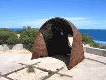
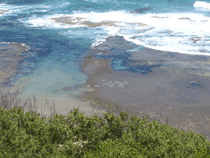
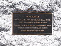
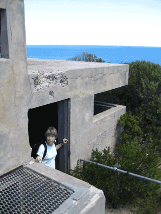
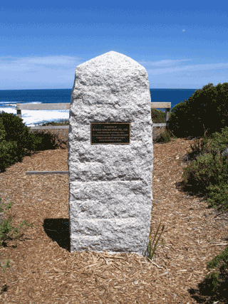
This is the southern most point on the Mornington peninsula and constitutes the eastern head of the entrance to Port Phillip Bay. It is the site of an old fort established for defense during the early days of colonization and also during World War II. It is currently a museum and park that one must hike to reach. The old fort with its connecting tunnels and gun emplacements is quite a sight to behold. There is a beach on the south side of the park where Australia's prime minister, Harold Holt, disappeared in the sixties. The park has erected a monument to the event and this beach is off-limits to the general public. Actually, the entire park is still owned by the military and much of it is closed off to the general public. It was a firing range (and might still be) so there is plenty of unexploded ordinance that is still lying around as is typical of such facilities.
 |
 |
|||
| Old WWII bunker | Holt monument | |||
Mornington Peninsula -- The east side of Port Phillip Bay forms the west coast of the Mornington peninsula. It has become the retirement venue of many a Melbourne couple but these days you need to have been financially successful in order to afford to move there. I was most impressed by the casual atmosphere of the towns and the sheer cleanliness of the water. It is hard to believe that such clean water exists so close to a major metropolitan area.
The Twelve Apostles
 |
 |
 |
|||||
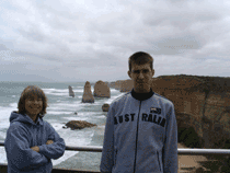
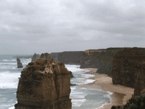
| Edite and Dan | Looking east | ||||||
| Looking west | |||||||
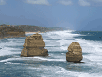
Further down the south coast of Australia near the town of Port Campbell lies a geological phenomenon made of sandstone consisting originally of twelve pillars standing hundreds of feet high. These monoliths together are referred to as the Twelve Apostles. Unfortunately, the ravages of time and weather have caused six of them to crumble into the sea, one as recently as last year. They are a major tourist attraction, and a visitor center has been erected on the site for folks to park properly and read about the history and geology.
Cape Otway Point
 |
 |
 |
|||||
|
The historic lighthouse |
A view from the railing | Danger! | |||||
 |
|||||
 |
|||||
| The dangerous rocks | |||||
 |
|||||
|
One of the remaining lenses |
The Fresnel Lens system | ||||
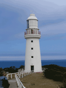
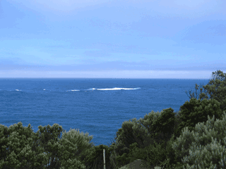
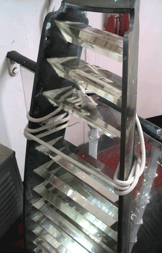
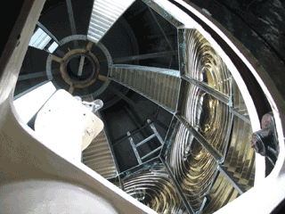
This site was established in the 1850s as an aid to shipping, as the rocks off the point had claimed many a ship on its way to and from Melbourne. There is a lighthouse on the site complete with keeper residence and a telegraph station was also established on the property as a relay point for an underwater cable that was laid at the end of the 19th century between Cape Otway and Tasmania over King Island. The cable lasted only 18 months before it failed completely and was abandoned. Today, the lighthouse is a museum and the navigational duties have fallen to a small solar powered beacon located just in front of the original lighthouse structure.
|
Melbourne |
|---|